
Table of Contents
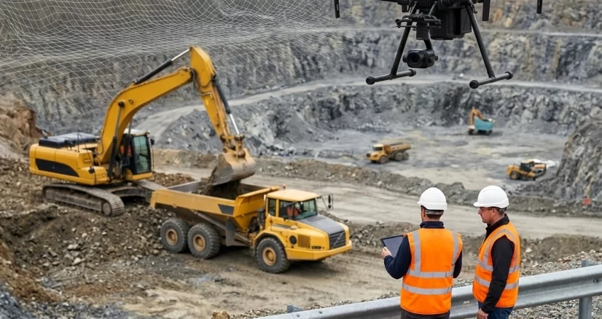
Walk into any limestone quarry today and you’ll notice something different overhead. It’s not a helicopter, and it’s not a survey crew hauling equipment up a steep bench. It’s a drone, quietly gathering data that used to take days to collect on foot.
Drone-based limestone mine surveying has quietly become one of the most practical upgrades a mining operation can make. It’s faster, safer, and honestly, it just makes more sense for sites with uneven terrain, active blasting zones, and constantly shifting stockpiles.
If you’re still relying on traditional total-station surveys or manual measurements, this article will walk you through why so many limestone operators are switching to drones, and what it actually looks like in practice.
Why Limestone Mines Are a Perfect Fit for Drone Surveying
Limestone quarries have a few characteristics that make them especially well-suited to aerial data collection.
The terrain is often steep, dusty, and irregular. Benches change shape every week as extraction continues. And safety is always a concern, especially near high walls or freshly blasted rock.
A drone doesn’t need a stable path to walk. It doesn’t need to get close to a loose ledge or wait for dust to settle before taking a reading. It simply flies over the area and captures everything in one pass.
That single difference changes the entire surveying workflow.
The Shift From Manual Surveys to UAV Surveying
Traditional survey methods rely on people physically walking the site with GPS rods or total stations. It works, but it’s slow, and it puts surveyors in areas that aren’t always safe.
UAV surveying flips that approach. Instead of measuring point by point on the ground, a drone captures thousands of data points from above in a matter of minutes.
For a limestone mine spread across dozens of hectares, that’s not a small improvement. It’s the difference between a survey taking a full day and one taking an hour.
How Drone Mapping Actually Works on a Mine Site
Drone mapping isn’t just about flying a camera over a quarry and hoping for the best. There’s a structured process behind it.
First, the drone follows a pre-planned flight path, usually programmed using mapping software that ensures consistent overlap between images. This overlap is important because it’s what allows the data to be stitched together accurately later.
Once the flight is complete, the images are processed using photogrammetry software. This software analyzes overlapping photos and reconstructs the terrain in three dimensions, essentially rebuilding the mine site as a digital model.
For limestone mines specifically, this means engineers can see exact bench heights, slope angles, and stockpile volumes without ever setting foot near the edge of a pit.
Photogrammetry vs LiDAR: Which One Fits Your Mine
Two technologies tend to come up whenever drone mapping is discussed: photogrammetry and LiDAR. They both create accurate 3D models, but they work differently and suit different conditions.
Photogrammetry relies on high-resolution photos and works best in open areas with good lighting. It’s cost-effective and produces highly detailed visual models, which is useful for stockpile measurement and general site mapping.
LiDAR, on the other hand, uses laser pulses to measure distance and can penetrate through vegetation or dust to some extent. For limestone mines with tree cover around the perimeter or frequent dust in the air, LiDAR often delivers cleaner results.
Many operations end up using both, depending on the season, weather conditions, or the specific part of the mine being surveyed that week.
Turning Raw Data Into 3D Mine Mapping
Once the data is collected, whether through photogrammetry or LiDAR, it gets converted into a usable 3D mine mapping model.
This isn’t just a pretty visual for a report. It’s a working tool. Engineers use these models to calculate extraction volumes, track how much material has been removed since the last survey, and plan the next blasting sequence with far more precision.
Because the model is digital, it can be compared against previous surveys almost instantly. That means teams can spot erosion, subsidence, or unexpected changes in slope stability before they become real problems.
Key Benefits of Drone-Based Limestone Mine Surveying
Here’s a closer look at what makes this approach genuinely useful for limestone operations, not just a trendy upgrade.
- Significantly faster data collection compared to ground-based surveys, often cutting survey time from days to hours
- Improved worker safety, since staff no longer need to walk near unstable slopes or high walls
- Highly accurate volume calculations for stockpiles, which directly supports better inventory and production planning
- Consistent, repeatable data that makes it easy to compare surveys month over month
- Reduced downtime, since drone flights don’t require halting active mining operations for long
- Better slope stability monitoring, helping teams catch early warning signs of erosion or shifting rock
- Lower long-term costs, as fewer survey crews and less equipment are needed on-site
- Detailed visual records that support compliance reporting and communication with regulatory bodies
- Easier collaboration between site engineers, management, and external consultants through shareable 3D models
- Flexibility to survey hard-to-reach or hazardous zones that were previously avoided altogether
Each of these benefits adds up over time. It’s rarely one dramatic change that convinces a mine manager to switch. It’s the steady accumulation of saved hours, fewer safety incidents, and better decisions based on more reliable data.
Getting Started With Drone Surveying at Your Mine
If your operation is still relying purely on traditional methods, the transition doesn’t have to happen all at once. Many limestone mines start by using drones for stockpile volume checks, since that’s an easy win with immediate cost benefits.
From there, it usually expands into full-site mapping, slope monitoring, and eventually integration with the mine’s broader planning software.
The equipment and software have also become far more accessible in recent years, which means smaller operations can now benefit from tools that were once limited to large mining corporations.
Final Thoughts
Drone-based limestone mine surveying isn’t just a technology trend passing through the industry. It solves real, everyday problems that limestone mine operators deal with constantly: unsafe terrain, slow data collection, and the need for accurate volume tracking.
Whether it’s through photogrammetry, LiDAR, or a combination of both, the result is the same: a clearer, more current picture of what’s actually happening on-site.
For any limestone mine looking to improve efficiency without cutting corners on safety, drone surveying is worth serious consideration. It’s not about replacing experienced surveyors, it’s about giving them better tools to do their job well.
Need expert help with this? See how TECHCEM’s raw material investigation services can support your project.